Long Island: June-August 1776

The Strategic Importance of New York City

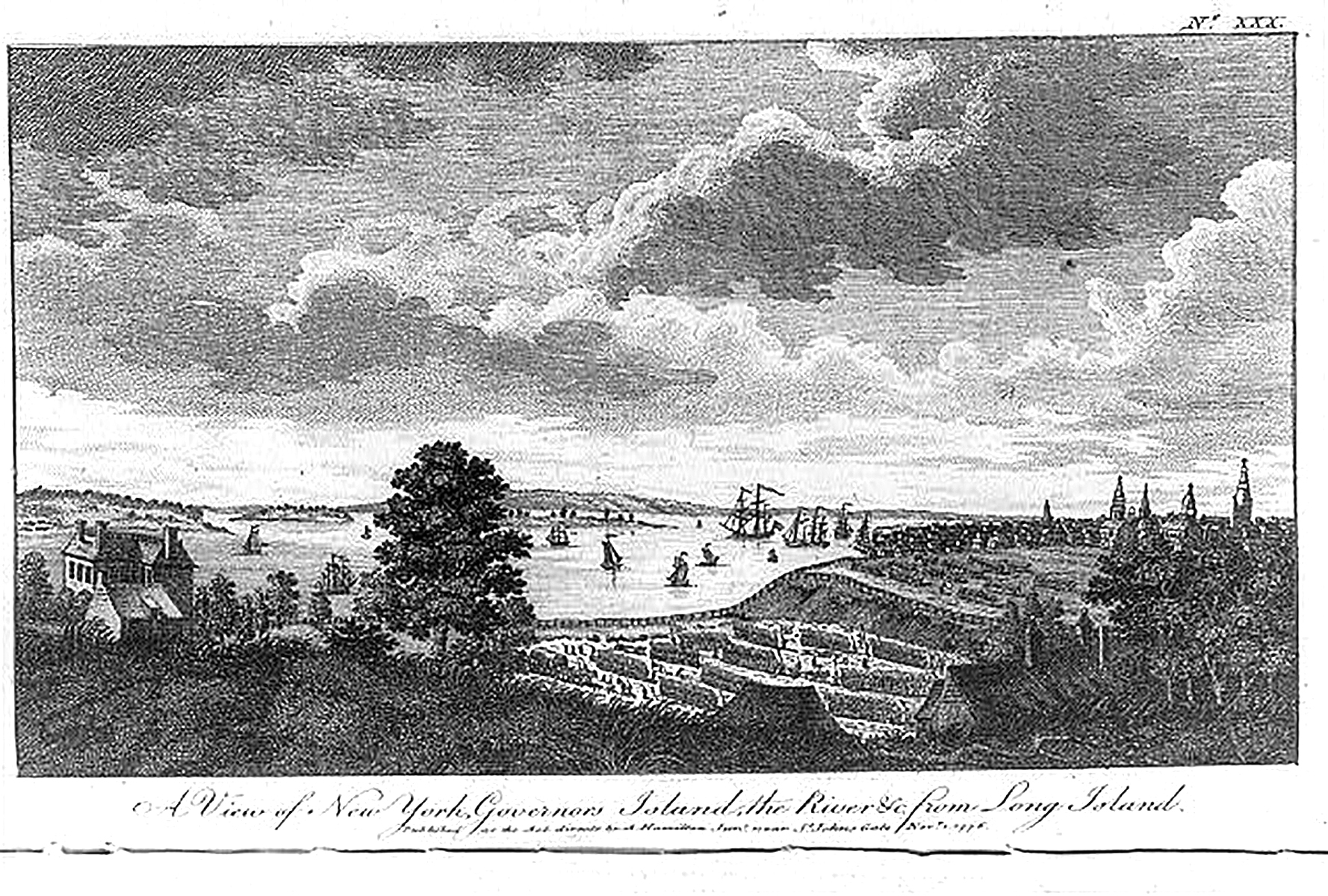
Canot, Pierre Charles. A view of New York, Governors Island, the river &c. from Long Island. New York City New York United States, 1776. [London: Published as the Act directs by A. Hamilton Junr., near St. John’s Gate, Novr. 1] Photograph. Library of Congress.

Canot, Pierre Charles. A view of New York, Governors Island, the river &c. from Long Island. New York City New York United States, 1776. [London: Published as the Act directs by A. Hamilton Junr., near St. John’s Gate, Novr. 1] Photograph. Library of Congress.

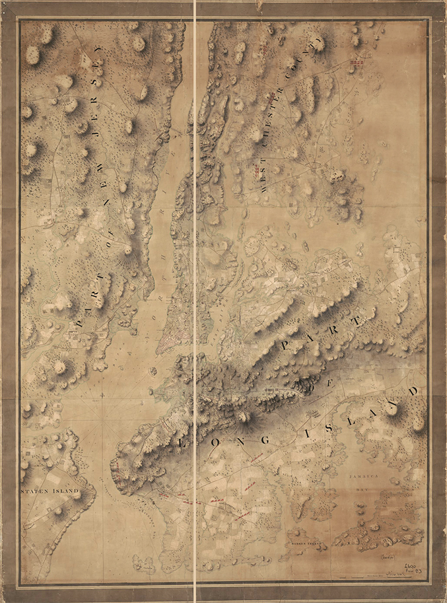
Manuscript map of British and American troop positions in the New York City region at the time of the Battle of Long Island Aug.-Sept. [?, 1776] Map. Library of Congress.

Manuscript map of British and American troop positions in the New York City region at the time of the Battle of Long Island Aug.-Sept. [?, 1776] Map. Library of Congress.

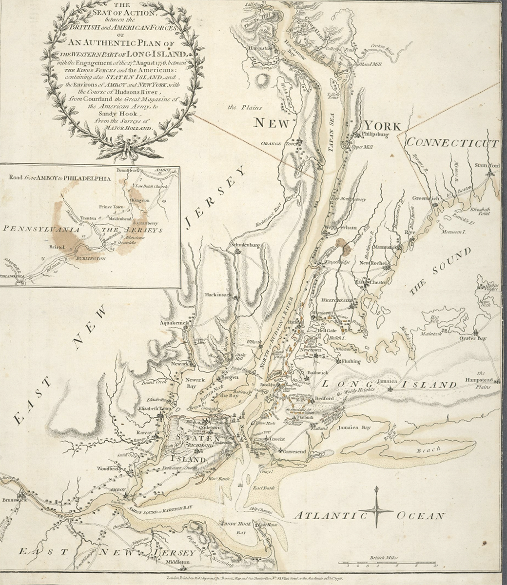
Lionel Pincus and Princess Firyal Map Division, The New York Public Library. “The seat of action between the British and American forces: or An authentic plan of the western part of Long Island, with the engagement of the 27th August 1776 between the King[‘]s forces andthe Americans : containing also Staten Island, and the environs of Amboy and New York, with the course of Hudsons River, from Courtland, the great magazine of the American Army, to Sandy Hook.” New York Public Library Digital Collections.

Lionel Pincus and Princess Firyal Map Division, The New York Public Library. “The seat of action between the British and American forces: or An authentic plan of the western part of Long Island, with the engagement of the 27th August 1776 between the King[‘]s forces andthe Americans : containing also Staten Island, and the environs of Amboy and New York, with the course of Hudsons River, from Courtland, the great magazine of the American Army, to Sandy Hook.” New York Public Library Digital Collections.

Positioned at the southern end of Manhattan Island where the ocean waters of the Atlantic mingled with the fresh water flowing south from Canada, New York City The system of waterways that connected New York City to Canada, a network that ran from the Hudson River to Lake George and then to Lake Champlain, provided the most efficient invasion route between the American colonies and the British strongholds to the north. A member of the Second Continental Congress, Massachusetts delegate John Adams, observed that whomever controlled New York City and its extensive port and warehouse facilities enjoyed a strategic advantage in the war.

"That it is expedient, and even necessary to be done, by Some Authority or other, I believe will not be doubted by any Friend of the American Cause, who considers the vast Importance of that City, Province, and the North River which is in it, in the Progress of this War, as it is the Nexus of the Northern and Southern Colonies, as a Kind of Key to the whole Continent, as it is a Passage to Canada to the Great Lakes and to all the Indians Nations. No Effort to secure it ought to be omitted."

John Adams' letter to George Washington on 6 January 1776.
Sources
  • www.founders.archives.gov