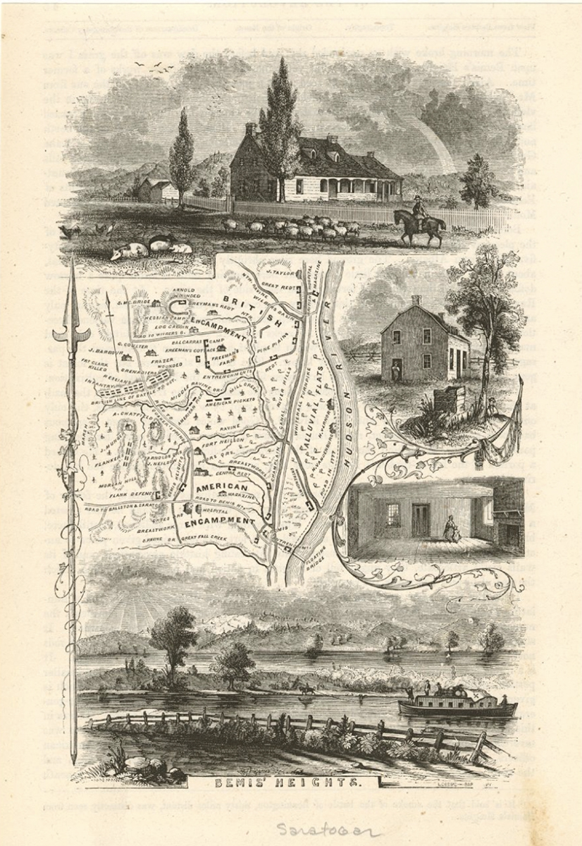
The terrain that Colonel Kosciuszko selected for fortification proved to be ideal for defense. Cannon placed on top of Bemus Heights dominated both the Hudson River and the main road running alongside it. In September, with the harvest over, thousands of militia came into the American camp and went to work digging trenches and gun positions. Gates’ men, who now outnumbered their enemy, waited for Burgoyne to make his next move.
"Gates’ right occupied the brow of the hill near the river, with which it was connected by a deep entrenchment; his camp, in the form of a segment of a great circle, the convex toward the enemy, extended rather obliquely to his rear, about three-fourths of a mile to a knoll occupied by his left; his front was covered from the right to the left of the centre, by a sharp ravine running parallel with his line and closely wooded: from thence to the knoll at his extreme left, the ground was partially cleared, some of the trees being felled and others girdled, beyond which in front of his left flank, and extending to the enemy’s right....The extremities of this camp were defended by stoney batteries, and the interval was strengthened by breastwork without entrenchments, constructed of the bodies of felled trees, logs, and rails with an additional battery at an opening left of the center. The right was almost impracticable; the left difficult of approach."
Lt. Col. James Wilkinson, aide to General Gates
Sources
Steven E. Clay. “Staff Ride Handbook for the Saratoga Campaign, 13 June to 8 November 1777.” Fort Leavenworth, KS: Combat Studies Institute Press, US Army Combined Arms Center, 2018, pp. 218-219.
![Wilkinson, William Cumberland. Plan of the encampment and position of the army under His Excelly. Lt. General Burgoyne at Bræmus Heights on Hudson’s River near Stillwater on the 20th Septr. with the position of the detachment &c. in the action of the 7th of Octobr. & the position of the army on the 8th Octr. [?, 1777] Map. Library of Congress.](https://www.thenmusa.org/wp-content/uploads/2025/12/Screenshot-2025-12-04-at-3.36.43 PM.png)